Conferenceseries LLC Ltd invites all the participants across the globe to attend the 2nd International Convention on Geosciences and Remote Sensing which is going to be held at Las Vegas, Nevada, USA during November 8-9, 2017 with the theme of “Recent upsurge in Geosciences and Remote Sensing : International Prospective”.
Geosciences and Remote Sensing Summit will provide a unique scientific and technical platform to share the research experiences among the best-available experts and professionals from all over the world engaged in different fields of Geosciences and Remote Sensing. Geosciences and Remote Sensing conferences aim to place a forum with the foremost academic scientists, geoscientists, young researchers from all over the world. The important features of this conference are well organized workshops, events and symposia, poster presentations and world class exhibits, panel discussions & interactive sessions, collaborative research opportunities.
Track :1 GEOSCIENCES
Geosciences is the study of the Earth. It is an exciting science with many practical and interesting applications. It is the study of critical issues like energy, meteorology, mineral and water resources, oceanography, planetary science reducing natural hazards for society. Many different sciences are used to learn about the earth, however, the four basic areas of Geoscience study are geology, oceanography meteorology and astronomy. It also includes the study of the hydrosphere, atmosphere, biosphere, and lithosphere. Earth scientists will use tools from physics, chemistry, chronology, biology and mathematics to build a quantitative understanding of how the Earth system works, and how it evolved to its current state. Geoscientists use physics, biology, chemistry, mathematics and computing to understand the planet as a natural system. Topics in the field include geology, petroleum geology, oceanography, climatology, geophysics and geochemistry. Some of the Earth scientists use their knowledge of the Earth to locate and develop mineral and energy resources. Others study the impact of human activity on Earth's environment and design methods to protect the planet. Two important subfields of geology are volcanology and seismology. These sciences can help predict the perils and mitigate the effects of natural hazards like earthquakes, volcanic eruptions, tsunamis and landslides.
-
Atmospheric Sciences
-
Geochemistry
-
Geomorphology
-
Stratigraphy
-
Geophysics and Geodesy
-
Crystallography
-
Hydrology
-
Vulcanology
Track :2 GEOLOGY
Geology is the study of the Earth, including the materials that it is made of the chemical processes and physical processes that occur on its surface and in its interior, and the history of the planet and its life forms. The study of changes in the planet and the life it harbours; over the course of time is an important part of geology. Structural Geology study the fracturing, folding, faulting and other forms of deformation experienced by rocks below the Earth's surface, and are also interested in how these processes relate to global Plate Tectonics. Petrology study the origins and characteristics of igneous, metamorphic and sedimentary rocks. Petroleum Geology explore for and help produce petroleum and natural gas from sedimentary rocks. Petroleum geology involves the extensive study of sedimentology and stratigraphy. Palaeontology study the remains of ancient animals and plants (fossils) in order to understand their behaviour’s, environmental circumstances, and evolutionary history. Environmental Geology study the environmental effects of pollution on ground and surface waters and surficial materials (sediment, rock and soil), and also solutions to environmental problems. They are also interested in understanding, mitigating and predicting the effects of natural hazards, such as erosion, flooding, landslides, volcanic eruptions, earthquakes, etc.
-
General Geology
-
Analyzing 3D geologic data using Modern statistical methods
-
Mineralogy
-
Mining Geology
-
Petroleum Geology
-
Historical Geology
-
Geological Modelling
-
Economic Geology
Track :3 PALEONTOLOGY
Palaeontology is the study of what fossils tell us about the ecologies of the past, about evolution, and about our place, as humans, in the world. Palaeontology incorporates knowledge from geology, biology, anthropology, ecology, archaeology, and even computer science to understand the processes that have led to the origination and eventual destruction of the different types of organisms since life arose. Micropaleontology is the Study of generally microscopic fossils, regardless of the group to which they belong. Taphonomy is the study of the processes of decay, preservation, and the formation of fossils in general. Paleoecology is study of the ecology and climate of the past, as revealed both by fossils and by other methods. Many people think palaeontology is the study of fossils. In fact, palaeontology is much more.
-
Charles Darwin’s Theory of Evolution
-
Imaging for the study of fossils and Magnetic resonance spectroscopy
-
Histology
-
Evolution of Development and Biomolecules
-
Vertebrate and Invertebrate Paleontology
-
Finite Element analysis in Paleontology
-
Paleobotany
-
Morphology
-
Ichnology
-
Advances in Paleontology
-
Paleobiogeography
Track :4 STRUCTURAL GEOLOGY
Structural Geology is study of rock deformation. Study of how the lithosphere is bent , broken , and deformed during plate tectonics. Structural Geology is important for understanding the location of earthquakes, Formation of mountains and Tectonic history of the earth. The primary goal of structural geology is to uncover information about the history of deformation (strain) in the rocks using measurements of present day rock geometries, and ultimately, to understand the stress field that resulted in the observed strain and geometries. It is a main part of Engineering Geology, which is concerned with the mechanical and physical properties of natural rocks. A tectonic plate can be defined as a rigid rock mass of lithosphere floating over viscous and semi liquid and the less dense asthenosphere. The floating movement is defined as rate of movement of a tectonic plate. The plate boundaries can be of different types where the plates either diverge, converge or pass by each other. The process that takes place at plate boundaries is called the crustal deformation. The difference between structural geology and tectonics is that structural geology deals predominantly with the study of small scale deformation, from sub microscopic to regional. Tectonics deals with deformation on a global scale, for instance at the level of a whole region or a continent, or a whole plate.
-
Structural Analysis
-
Geodynamics
-
Tectonic and Tectono -Thermal Modelling
-
Neotectonics
-
Crust and Mantle Evolution
-
Tectono stratigraphy
-
Micro and Macro Structures
-
Movements of Plate Tectonics
-
Natural Hazards and Disasters
-
Earthquake occurrence in different Tectonic Plates
-
Stress, Strain and Rheology of the Lithosphere
Track :5 PHYSICAL GEOLOGY
Physical geology is the branch of geology that deals with the geologic events and materials occurring at the present time or in the very near past. This is in contrast to historical geology, which involves studying the rock record and fossil record for evidence of past geologic processes, life forms and materials. Physical geologists study current processes, like erosion, volcanoes, earthquakes, glaciers, and weathering. They use their understanding of historical geological processes to understand what might be causing current geologic processes to take place, as well as utilizing new techniques and technologies. Physical geologists share some similarities with medical doctors, in that they use a combination of prior knowledge and newly acquired technology and knowledge to help solve scientific problems. Physical geologists must also have a solid understanding of other branches of science, like physics, biology and chemistry, in order to fully understand the geological processes and interactions that are important to them.
-
Geologic activity of Ground water
-
Formation of Minerals
-
Erosion and Mass Wasting
-
Metamorphism and Metamorphic Rocks
-
Evolution of Landscapes
-
Fossils and Evolution
-
Glaciers and Ice ages
-
Geological Time and Earth History
-
Continental Drift and Plate Tectonics
-
Faults and Earthquakes
-
Planetary Geology
-
Geologic Resources
-
Weathering and Climate Change
-
Forecasting Earthquakes and Minimizing Damage and Casualities
-
Measuring Earthquakes
Track :6 ENVIRONMENTAL GEOLOGY
Environmental Geology is investigates the relationship between society and the geologic environment. The three areas of study e three areas of study will be: will be: 1) geologic hazards such as floods, landslides, volcanoes and earthquakes; landslides, volcanoes and earthquakes; 2) geologic resources such as metals, stone, fossil fuels, and resources such as metals, stone, fossil fuels, and water; and, water; and 3) environmental challenges such as waste disposal and ground water contamination. The fundamentals concepts of environmental geology are Human population growth, Hazardous earth processes, Sustainability, Earth as a system etc. Research on environmental geology emphases on the chemical and physical processes occurring at or near Earth’s surface impacting by human activities. Hydrogeology is the important now a days as some parts of the world are blessed with frequent rainfall and plentiful surface water resources, but most of the countries need to use water that is stored underground to supplement their needs. Environmental geology applies geologic information to the prediction, solution and study of geologic problems such as Earth materials, Landscape evaluation, Natural hazards, Environmental impact analysis and remediation.
-
Geological and Hydrogeologic Resources
-
Environmental Mineralogy and Edaphology
-
Coastal Hazards
-
Earth Surface Process and Plate Tectonics
-
Importance of Chemical Structure in the Environment
-
Polar Environment and Ecosystems
-
The Rock Cycle
-
Global Warming and Climate change
-
Geologic Hazards and Management
-
Chemical reactivity in the EnvironmentalSystem
Track :7 SEISMOLOGY AND PALEOSEISMOLOGY
Seismology is science that studies these waves and what they tell us about the structure of the Earth and the physics of earthquakes. It is the primary means by which scientists learn about the Earth’s deep interior, where direct observations are impossible, and has provided many of most important discoveries regarding nature of our planet. It is also directly concerned with understanding physical processes that cause earthquakes and seeking the ways to reduce their destructive impacts on the humanity. Seismology occupies an interesting position within the more general fields of Earth sciences and geophysics. It presents the fascinating theoretical problems involving analysis of elastic wave propagation in the complex media, but it can also be applied simply as a tool to examine the different areas of interest. Seismology is comparatively young science that has only been studied quantitatively for about 100 years. Reviews of history of seismology include Dewey and Byerly (1969) and Agnew (2002). Early thinking about the earthquakes was, as one might expect, superstitious and not very scientific. It was noted that the earthquakes and the volcanoes tended to go together, and explanations for the earthquakes involving the underground explosions were common. Paleoseismology is the geological investigation of individual earthquakes decades, centuries, or millennia after their occurrence.
-
Elastic Rebound Theory
-
Green’s Function and the Moment Tensor
-
Modern Seismographs and Earth Noise
-
Refraction and Reflection Seismology
-
Geodesy and Statistics of Earthquakes
-
Earthquake Predication and Real Time Warnings
-
Anisotropy
-
Stress drop and Radiated Sesimic Energy
-
Microseismology and Macroseismology
-
Focal Mechanism and Waveform Modelling
-
Spreading Centers and Subduction Zones
-
Observation Seismology and Engineering Seismology
-
Tomography
-
Applications of Sesimology
-
Seismic Hazards and Risks
Track :8 PETROLOGY AND MINERALOGY
Petrology is the study of rocks, minerals and meteorites, their occurrence, origin, composition, evolution, evolution of solar system and the interior of planets. Processes involve tectonic movements of masses, volcanic eruptions and injections, solidification and crystallization, recrystallization and melting, sedimentation, weathering, metamorphism, megascopic and microscopic identification of rocks and minerals. The interior structure of the Earth from the core, mantle, lithosphere, continental and oceanic crust, hydrosphere, atmosphere to biosphere illustrated along with nebular theory of origin and age. Rocks have been classified into the three major genetic classes, igneous, sedimentary and metamorphic. Theory of the plate tectonics for current configuration of Earth lithosphere and the component continents with zone of subduction, plate boundaries such as convergent, transform and divergent are discussed. Orogenic movements through the collision and non collision are explained.
Mineralogy is the subject of geology specializing in the scientific study of the crystal structure, chemistry, and physical (including optical) properties of minerals and the mineralized artifacts. Specific studies within the mineralogy include the processes of mineral origin and the formation, classification of the minerals, and their geographical distribution, as well as their utilization.
-
Petrogenesis and Petrochemistry
-
Igneous. Sedimentary and Metamorphic Petrology
-
Experimental Petrology
-
Metamorphic Minerals, Processes and Structures
-
Metamorphism
-
Deposits of Chemical and Organic Origin
-
Residual Deposits
-
Textures and Microstructures
-
Composition and Constitution of Magmas
-
Volcanic and Explosive Eruptions
-
Optical Mineralogy
-
Refractometry
-
Isotropic, Uniaxial and Biaxial Minerals
-
Evolution of Mineralogy
-
Rock Forming Minerals
-
Crystal Structure and Composition of Minerals
Track :9 ENGINEERING GEOLOGY
Engineering geology is application of the geological knowledge in engineering works. It has wide applications in the various engineering fields especially in urban planning and expansion. Site investigation for major structures such as factories, dams, and the heavy buildings is one of the main parts of engineering applications. Others includes the earth material characterization, exploration and the assessment of construction materials and the assessment of difficult grounds such as sabkha, collapsible and expansive soils. The obtained information can be presented in the form of engineering geological maps, which is essential in several projects. Engineering geology studies are performed by a engineering geologist or geologist that is educated, trained and has obtained experience related to the recognition and interpretation of the natural processes, the understanding of how these processes impact human made structures and knowledge of methods by which to mitigate against the hazards resulting from the adverse natural or human made conditions. The principal objective of the engineering geologist is the protection of life and the property against damage caused by the various geological conditions.
-
Soil Classification
-
Ground Water Pollution
-
Geotechnical and Geological Engineering
-
Mining Engineering
-
Petroleum Engineering
-
Soil and rock Mechanics
-
Geospatial Analysis and Geological Mapping
-
Earthquake Engineering
-
Engineering mitigation of Volcanic geohazards
-
Subsurface Exploration
-
Karst Topography and Underground drainage
-
Fluvial Processes
-
Engineering behaviour of Sedimentary rocks
-
Wind action and Desert Landscapes
-
Properties and Behaviour of Soils and Rocks
-
Remote Sensing for Earth Sciences applications & GIS
-
Geological Hazards
Track :10 OCEANOGRAPHY
Oceanography is study of all aspects of the ocean. Oceanography covers a wide range of topics, from the marine life and ecosystems, to the currents and waves, to the movement of sediments, to seafloor geology. The study of the oceanography is interdisciplinary. The ocean’s properties and the processes function together and cannot be examined separately from one another. The chemical composition of the water, for example, influences what types of organisms live there. In turn, organisms provide sediments to geology of the seafloor. Oceanography’s diverse topics of study are generally categorized into four major sub disciplines. A sub discipline is the specialized field of study within a broader subject or discipline. Oceanographers specialize in the geological, biological, physical and chemical processes of the marine environment.
-
Physical Oceanography and Climate dynamics
-
Biological Oceanography
-
Fisheries Oceanography
-
Ocean Biogeochemistry
-
Climate change and Polar Ocean Ecosystems
-
Marine Pollution
-
Marine Engineering and Technology
-
Coastal Oceanography
-
Marine data Management
-
Marine Geology and GIS application
-
Marine Biology
-
Shipping Problems: Toxic Anti-Fouling paints
-
Ocean Acidification
-
History of Oceanography
-
Ocean Waves and Tides
-
Shallow water and Coastal processes
Track :11 GEOPHYSICS
Geophysics is the application of method of physics to the study of Earth. The rocks does not differ only by their microscopic or macroscopic properties studied field petrologists or geologists. They also differ by their physical and chemical properties. Hence as the rocks differ according to their origin, texture, structure, etc. they also differ by their magnetisation, density, resistivity, etc. However, modern geophysics organizations use a broader definition that includes water cycle including ice and snow; fluid dynamics of the oceans and atmosphere; magnetism and electricity in the magnetosphere and ionosphere and the solar-terrestrial relations; and the analogous problems associated with the Moon and the other planets. Geophysics is applied to societal needs, such as mitigation of natural hazards, mineral resources, and environmental protection. Geophysical survey data are used to analyse mineral deposits and potential petroleum reservoirs, locate groundwater, find archaeological relics, determine the thickness of the glaciers and soils, and assess sites for environmental remediation.
-
Applied Geophysics and Exploration Geophysics
-
Geophysics in Ground Water Investigation
-
Geophysics for Mineral Exploration
-
Glacio-geophysics
-
Uncertainty in Geophysics
-
Physical Properties of rocks
-
Geophysical and Geoelectrical Methods
-
Electrical Resistivity, Imaging, Soundings and Profiling
-
Seismic Reflection Surveying and Seismic Refraction Surveying
-
Geophysical data processing
-
Geophysical borehole logging
-
Gravity Anomalies and their Interpretation
-
Gravimetry and Magnetometry
-
Advantages of Geophysical Applications
-
Geophysical Imaging and Reservoir Characterization
-
Ground Penetrating Radar (GPR)
Track :12 REMOTE SENSING
Remote sensing can be defined as the collection of the data about an object from a distance. Humans and many other types of animals accomplish this task with an aid of eyes or by the sense of smell or hearing. Geographers use technique of remote sensing to the monitor or measure phenomena found in Earth's, biosphere, hydrosphere, lithosphere and atmosphere. Remote sensing of environment by geographers is usually done with the help of the mechanical devices known as remote sensors. These gadgets have a greatly improved ability to receive and to record information about object without any physical contact. Often, these sensors are positioned away from the object of interest by using planes, helicopters, and satellites. Most sensing devices record information about an object by measuring an object's transmission of the electromagnetic energy from the reflecting and radiating surfaces. Remote sensing imagery has many applications in the mapping land use and cover, soils mapping, agriculture, city planning, forestry, military observation, archaeological investigations and geomorphological surveying, among the other uses. For example, foresters use aerial photographs for preparing the forest cover maps, locating possible access roads, and the measuring quantities of trees harvested. Specialized photography using colour infrared film has also been used to detect the disease and insect damage in the forest trees.
-
Passive and Active Sensor Systems
-
Radiometric and Geometric Resolutions
-
RADAR and LIDAR Remote Sensing
-
Image Processing pattern recognition
-
Radiophotography
-
Remote Sensing Techniques
-
Urban Remote Sensing
-
Change detection remote sensing
-
Earth Observation and Satellite data
-
Radiometry
-
Planetary Remote Sensing
-
Environmental Remote Sensing
Track :13 APPLICATIONS OF REMOTE SENSING
Remote Sensing application is a software application that processes the remote sensing data. Remote sensing applications are similar to the graphics software, but they enable generating geographic information from satellite and the airborne sensor data. Remote sensing applications read specialized file formats that contain georeferencing information, sensor image data, and sensor metadata. Some of the most popular remote sensing file formats are NITF, GeoTIFF, ECW (file format), JPEG 2000,MrSID, NetCDF, and HDF. Remote Sensing applications perform many features including Change Detection, Orthorectification, Spectral Analysis,Image Classification. Many remote sensing applications are built using the common remote sensing toolkits, like OSSIM and GDAL.
-
Remote Sensing in Meteorology
-
Remote Sensing in Oceanography
-
Remote Sensing in Glaciology
-
Remote Sensing in Geology
-
Remote Sensing in Geodesy
-
Remote Sensing in Topography and Cartography
-
Remote Sensing in Agriculture
-
Remote Sensing in Forest
-
Remote Sensing in Botany
-
Remote Sensing in Hydrology
-
Remote Sensing in Planning applications
-
Remote Sensing in Land Cover Classification
Track :14 GIS
A Geographic Information System (or GIS) is a system designed to store, capture, manipulate, manage, analyse, and present geographical or spatial data. The acronym GIS is sometimes used for the geographic information science (GIS) to refer to the academic discipline that studies the geographic information systems and it is a large domain within the broader academic discipline of geoinformatics. What goes beyond a GIS is spatial data infrastructure, a concept that has no such restrictive boundaries. In general, the term describes any information system that stores, integrates, analyses, edits, shares, and displays the geographic information. GIS applications are the tools that allow users to create interactive queries, edit data in maps, analyse spatial information, and present the results of all these operations. GIS science is the science underlying applications, geographic concepts, and systems.
GIS is a broad term that can refer to a number of different processes, technologies and methods. It is attached to many operations and has many applications related to planning, engineering, transport/logistics, management, telecommunications, insurance, and business. For that reason, GIS and location intelligence applications can be the foundation for many location-enabled services that rely on visualization and analysis.
-
Geospatial Infrastructure
-
Geovisualization
-
Data Characteristics and Visualization
-
Cartographic Principles
-
GIS Automation in map production and visualization
-
Map Anatomy
-
Geospatial Data Management
-
GIS decision support and models
-
Satellite Imagery
-
Aerial Observation
-
GIS in natural resources
-
Geomatics
-
Geospatial Technology for Energy, Health, Pollution, etc.,
-
GIS application in Resource Management
-
GIS in Urban Planning and Land use Management
-
GIS in Transport System
-
GIS in Project Management
Track :15 GPS AND PHOTOGRAMMETRY
The GPS is a Global Navigation Satellite System (GNSS) developed by United States Department of Defence. It is only fully functional GNSS in the world. It uses a constellation of between the 24 and 32 earth orbit satellites that transmit precise radio signals, which allow the GPS receivers to determine their current location, the velocity, and the time. These satellites are the high orbit, circulating at 14,000km/hr and 20,000km above the earth's surface. The signal being sent to earth at the speed of light is what is picked up by any GPS receiver that are now common place worldwide. The first satellite navigation system, used by United States Navy, was first successfully tested in 1960. Using a constellation of the five satellites. A GPS receiver calculates its position by the precisely timing the signals sent by GPS satellites high above the Earth. Each satellite continually transmits the messages containing the time the message was sent, precise orbital information, and the general system health, current date and time of all GPS satellites. The receiver measures the transit time of each message and computes the distance to the each satellite. A form of triangulation is used to combine these distances with the location of the satellites to determine receiver's location. The position is displayed, perhaps with a moving map display or longitude and latitude; elevation information may be included. Many GPS units are also show information such as direction and speed, calculated from the position changes.
-
Satellite Geometry and Satellite Orbits
-
Atmospheric Effects
-
GPS in Marine Applications
-
GPS in Surveying Techniques
-
GPS in Mapping
-
Image Interpretation and Processing
-
GeoCorrection and Photogrammetry
-
GPS Error Sources
-
Differential GPS Techniques
-
Aerial and Close Range Photogrammetry Technology
-
Elements of Analytical Photogrammetry
-
Digital Photogrammetry workstations
-
Global System for Mobile Communication
Track :16 MULTI TEMPORAL DATA PROCESSING
Processing of the multi-temporal images and change detection has been an active research field in the remote sensing for decades. Although plenty successful application cases have been reported on monitoring and detecting the environmental change, there are enormous challenges on applying the multi-temporal imagery to derive timely information on earth’s environment and human activities. In recent years, a great progress has been observed to overcome the technological obstacles by development of new platforms and sensors. The wider availability of the large archives of historical images are also makes long-term change detection and modelling possible. Such a development stimulates further investigation in developing more advanced image processing methods and the new approaches in handling image data in the time dimension. Over the past years, researchers have put forward large numbers of the change detection techniques of the remote sensing image and summarized or classified them from different viewpoints. It has been generally agreed that the change detection is a complicated and integrated process. No existing approach is optimal and applicable to all cases.
-
Multitemporal image analysis techniques
-
Image registration, calibration and correction techniques
-
Classification of multitemporal data
-
Fusion and assimilation of multitemporal data
-
Data mining and analysis of remote sensing time series
-
Change detection methods
-
Change detection accuracy assessment
-
Multitemporal SAR and InSAR data analysis
-
Multitemporal LiDAR data analysis
-
Timelaps and multitemporal photogrammetric data analysis
-
Environmental reclamation monitoring and modeling
-
Vegetation dynamics and productivity
-
Water and ecosystem resources monitoring and modeling
-
New satellite missions for high temporal resolution time series
-
New satellite missions for very high spatial resolution time series
Track :17 LOCATION BASED SERVICES AND MOBILE GI APPLICATION
Services which use the location co-ordinates of end-user to improve the relevance, context, and value of application are defined as location based services (LBS). As per Webster’s New World Telecom Dictionary, LBS are services offered by the cellular radio providers that are sensitive the physical location of terminal device. Such services include descriptions of and directions to restaurants and other retail establishments in the proximity. However, now the services may not only be offered by the carriers alone.
LBS and Mobile GIS are critical to many businesses as well as the government organizations to the drive real insight from data tied to a specific location where the activities take place. The spatial patterns that location-related data and services can provide is one on its most powerful and the useful aspect where location is a common denominator in all of these activities and that can be leveraged to the better understand patterns and relationships.
-
Information Services
-
Location Based Social Media
-
Mobile Location-Based Gaming
-
Smart environments and ambient spatial intelligence
-
Geotagged big data
-
Personalization and context-aware adaptation
-
Visualization techniques for LBS
-
Novel user interfaces and interaction techniques
-
3D and augmented reality
-
Tracking
Track :18 GIS SOFTWARE
Geographic Information System software is designed to retrieve, store, display, manage, and analyse all types of the geographical and spatial data. GIS software lets you produce maps and the other graphic displays of geographic information for analysis and the presentation. With these capabilities a GIS is a valuable tool to visualize spatial data or to build decision support systems for use in the multiple organizations. GIS stores data on the geographical features and their characteristics. The features are typically classified as lines, or areas, points, or as raster images. On a map city the data could be stored as points, road data could be stored as lines, and the boundaries could be stored as areas, while aerial photos or the scanned maps could be stored as raster images. GIS stores the information using the spatial indices that make it possible to identify the features located in any arbitrary region of a map.
-
Image Management
-
Image Exporting
-
Near-Matching
-
Labelling
-
Interoperability
-
Map Creation
-
Geocoding
-
Census Data Integration
-
Reverse Geocoding
-
Spatial Analysis
Track :19 DISASTER ASSESSMENT AND MANAGEMENT
Geographic information system and remote sensing are the extremely valuable and powerful instruments in debacle administration. Different debacles like avalanches, surges, seismic tremors, fires, torrents, volcanic ejections and violent winds are common dangers that murder bunches of the individuals and pulverize property and the frameworks consistently. Avalanches are the most consistent geographical vulnerabilities in mountain locales, especially in the Sikkim Himalaya. Remotely detected information can be utilised productively to evaluate seriousness and effect of the harm because of these calamities. In the debacle alleviation stage, GIS, assembled with the global positioning system (GPS) is to a great degree valuable in inquiry and the protect operations in the ranges that have been crushed and where it is hard to discover one's direction. Catastrophe mapping is drawing of territories that have been through the inordinate characteristic or man-made inconveniences to typical environment where there is lost life, property and the national frameworks.
-
Assessing and prioritizing
-
Risk framework
-
Monitoring, reviewing and communicating
-
Relief and rescue team management
-
Disaster Response technologies
-
Web-based records management
-
Early Recovery alert
-
Emergency Management Industry
-
Multi-agency incident management
-
Real-time sensor and video integration
-
Emergency Response and Recovery
Track :20 REMOTE SENSING AND GIS MARKET
The most vital segment of Geographic Information Systems is its prerequisite for spatial information. Spatial information is any sort of data that has been gathered, assembled, or prepared with a spatial segment, that is, an attach to a geographic area on the surface of the Earth. It so happens this is a vast fragment of the spatial business; regularly expending an obvious part of dollars doled out to GIS usage ventures. Spatial information administration is progressively a thought in any data administration framework (IMS) because of the way that a lot of information is being gathered with spatial parts. Organizations and government associations understand that a customary IMS does not permit an association to influence the estimation of spatial data characteristic in their information. This has prompted to the advancement of programming devices as expansions to business Data Management Systems (DMS) that take into consideration better stockpiling, control, and inquiry of spatial information.
· Geospatial Industry
· Software applications and development
· Applied GIS
· Business Segments and Opportunities
· GIS economy
· Data collection and separation
· Research and Development
Track :21 ENTREPRENEURS INVESTMENT MEET
Geosciences - 2017 facilitates a unique platform for transforming potential ideas into great business. The present meeting/ conference create a global platform to connect global Entrepreneurs, Proposers and the Investors in the field of Geosciences and Remote sensing its allied sciences. This investment meet facilitates the most optimized and viable business for engaging people in to constructive discussions, evaluation and execution of promising business.
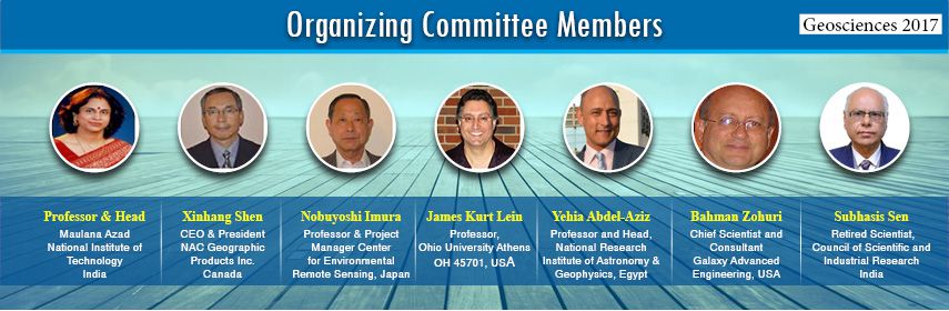
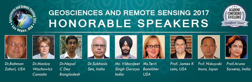
 James Kurt Lein
 Monica Wachowicz
 Nobuyoshi Imura
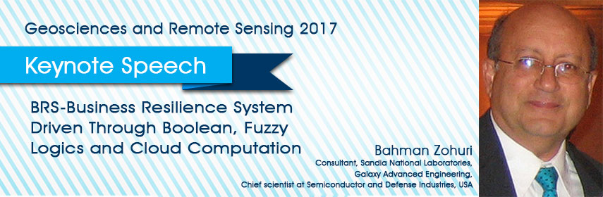
 Bahman Zohuri
 Nepal C Dey
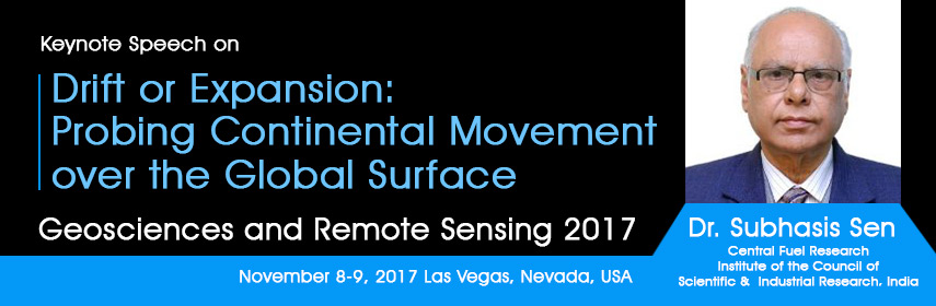
 Subhasis Sen
 Aruna Saxena
 Terri Bannister
 Vishavjeet Singh Goraya
  Ernest Berkman
 Zhipeng Lin
 Benyamin Sapiie
 Khodani Matshusa
 Don J Easterbrook
 Seyed Kazem Alavipanah
 Long Guo
 Muhammed Eltahan
 Akaninyene Okon Akankpo
 Siwei Li
 Najib Djamai
  Nashon J. Adero
 Odonkhuu Daria
 Sergey Gubanov
 Shanqin Wang
 Jiaying Chen
 Tanya Saxena
 Gervais W. Tabopda
  Tara P Banjade
 Laura Cutrer
  Abeer Mazher
 Chaitamart Jittin
 Mohammad Hossein Merrikhpour
  Sheila Lynch-Benttinen